Rtanj is a mountain in eastern Serbia that belongs to the Carpathian Mountains. The highest peak is Siljak, at 1565 m above sea level. Rtanj is also characteristic of its pyramidal shape and belongs to natural phenomena. The terrain is mostly open, and a small part of it is under forest. Rtanj has about twenty peaks in total. Besides Siljko, famous peaks are Preslo (1405m) and Kusak (1380m). In addition to its pyramidal shape, this mountain is also known for its tea and the mysticism that is sometimes associated with it.
Options for climbing Siljak Peak
There are four options for climbing to the top of Siljko from the south and north sides. You can research routes to Rtanj on the website of the Mountaineering Association of Serbia in the terrain database.
Ascent to the top of Siljak from the south side
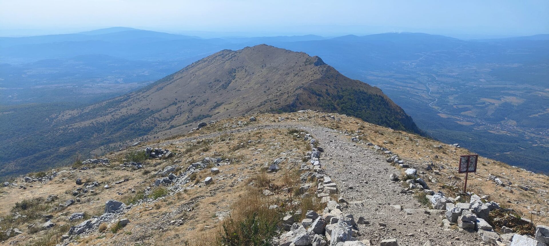
We chose the open and longest southern ascent route along the ridge of Rtanj. The trail is 5 km long in one direction and has about 800 m of ascent. The path starts from Tomic’s hut at the foot and continues relatively straight under the hill. These are almost 2 km long and are good for warming up the muscles before climbing to the top.
We started hiking almost at 1 pm, and the sun was at its strongest then. Climbing to the top is not risky, but the use of hiking poles is recommended. If you go to the top in the strongest sun, it is good to apply cream to prevent your skin from turning red. In addition, it is necessary to bring enough water for hydration. There is no possibility of getting water during the ascent. At 2 km from the beginning of the trail, there is a place for a break and refreshments, where you can only buy refreshments. After that, the ascent began.
Because of the open terrain, the sun is burning, and it is harder. The path is wide enough with a little shade in a couple of places, so it is possible to take a break. This climb is a good option, even for easy hiking. If you like a bigger challenge, there is an option to cross the hiking trails and go the steeper option.
The sun and never-ending ascent
It took us a little under three hours to climb, with a few short breaks. When we almost reached the top of Siljak, the peak only grew higher the closer you got. There is an interesting view of the surrounding hills at the top, but we didn’t need to stay there for more than five minutes.
We planned to return on the circular path, but due to the lack of water, we returned the same way. Every time you go hiking in high temperatures, you need to think carefully about what you have for refreshments and how much you can hike.